
Note I have revisited this trip in 2018 a Medium SEKI loop post here! Please use that one as it is more updated and detailed:) I recommend reading it to plan your camp sites as it follows the same route as over half the Big SEKI Loop!
This has been a real tetris of an endeavour. How do I fit 12 days of crap in a bag that is only designed for maximum 30-35lbs. Last time I checked, I eat a lot of food in 12 days! Now I have to add a shelter, clothing, toiletries, sleep system, cook system, fuel, water, first aid – oh my!
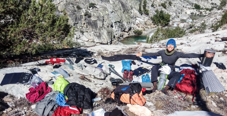
I spent a lot of time tinkering for this particular trip. Weekend trips are easy… if it’s under 10lbs without water it’s light! But I turned into a total gram weenie and measured *everything*. I even cut all the tags off of everything… it’s kind of embarrassing. The very first day of this trip is just over 5000ft gain to get to the lip before you drop into Granite Basin. I really didn’t want to lug up anything unnecessary with a full load and 12 days of food.
Pack
Pack – ULA Circuit – 40oz
Liner – Trash Compactor Bag – 2oz
TOTAL: 2.63lbs
Sleep System
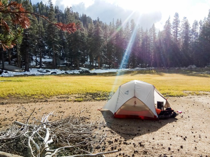
Tent – MSR Hubba Hubba NX2 with poles and stake bags removed – 3.18lbs
This is heavy and since I am traveling alone unnecessary but I love free standing tents at this point in my backpacking life, and I cannot afford a super ultralight silnylon anything 😦
Sleeping Bag – ZPack 20F – 15oz
Sleep Mat – Therm-a-rest NeoAir XLite Sleeping Pad – Womens – 12oz
Sleep Pad – Goassamer Thinlight Foam Pad – 1/8″ – 2.4oz
Sleep Liner – Sea to Summit – 8oz
Pillow – Sea to Summit – 2.8oz
TOTAL: 5.7lbs
Sleep Wear
Hat – GooseFeet Gear Down Balaclava – 1.5oz
Socks – GooseFeet Gear Down Socks – 2.6
Base Layer Pant – Ice Breaker Leggings – 8oz
Mittens – Wool Hudson Bay Canada – 2oz
Base Layer Top – REI base layer – 8oz
TOTAL: 1.4lbs
Cook System
Stove – Pocket Rocket 2 – 3.7oz
Fuel – MSR Fuel 16oz – 23 oz
Cup – Sea to Summit XCup – 91g (sorry for the mixed conversions I am Canadian and switch a lot)
Pot – Toaks Titanium 750mL (also my bowl) – 3.84oz
Spoon – Titanium Spoon – 12g
Bear Canister – Bearikade Expdition 36oz
Multi Tool – Gossamer Gear Branded mini tool – 22g
Lighter – 12g
Extra Clothing
Puffy – Outdoor Research Women’s Virtuoso – 10oz
Rain Poncho/Pack Cover – Nature Hike – 190g
Socks – Injiji Toe Socks – 31g x 2
Wool Sock – Smart Wool – 2oz
Underwear – Ex Officio Give N Go 0.9oz x 2
Rain Pants – Outdoor Research – 6oz
Flip Flops – Walmart – 3oz
Worn
Pants – REI brand hiking pant – 8oz
Sun Shirt – Under Armour Sunshirt with hood – 156g (I LOVE THIS SHIRT NO STINK!!!)
Boots – Solomon Hiking Boot 2lb
Socks – Injiji Toe socks – 31 g
Wool Socks – Smart Wool 2oz
Bra – Under Armour 3oz
Underwear – Ex Offico Give N Go 0.9oz
Baseball Cap – 2oz
Thin Liner Glove – 2 oz
Toiletries
Toilet Paper – (bidet life limited tp) – 0.5oz
Trowel – Deuce of Spades – 14g
Moon Cup – 21g in pouch
Hair Ties – x2 1g
Lip Balm – SPF 15 (stored in bear can) 0.15oz
Dehydrated Wipes – 0.1oz
Camp Soap -12g
Pack Towel – 10g
Ziplock – 5g
Toothbrush – 8g
Toothpaste – 18g
Hand Sanitizer 0.5oz
Pee Rag – lol best thing ever – 6g
Disposable Razor – luxury item #1 – 10g
Bidet Bottle 1.5oz (diner style ketchup bottle)
TOTAL 0.53lbs
First Aid
Medications (Sumatriptan Succinate, Advil, Pepto, Anti-biotics) – 20g
Second Skin Blister Relief – 40g
BandAid Sheet – 10g
Polysporin – 9g
Tensor Bandage – 80g
Tech
Phone – Android – 168g
USB Cables – 1oz
Battery Pack – 8.3oz
InReach – 6.8oz
Head Phones – 13g
Solar Panel – Anker 15W – 12.5oz
Misc
Map 92g
Compass – 5g
Hiking Poles – 1lb
Head Lamp – 100g
ID – 51g
Boot Laces – 20g (I have had these break before)
Tape – 15g (on hiking poles)
Food
Food for Trip – 15lb
Day 1 out of bear can food – 1lb
Water
1L Soft Bottle – 25g
Smart Water Bottle – 37g
Water – 3lb
Sawyer Mini – 63g
SmarTube Inline System – 40g
A very handy guide that is itemized and a fantastic planning website: https://lighterpack.com/r/fx7a4j (NOTE: I am re-planning this trip so it’s been updated with lighter gear as I am expanding my collection!!!)
The Adventure
I flew into Fresno, met up with a friend for some pizza and a beer, then rented my car out to Roads End. I arrived in the dark which was a bit overwhelming as I was by myself – not quite sure where to park, getting turned around in the camp ground. I stayed at the Sentinel camp ground out there which was super rowdy. I actually got no sleep even with ear plugs. I set up my tent but spent a few hours sleeping in the back seat of my rental car as it was a bit more sound proof. There was a fight in the tent across from me resulting in an altercation and I believe some folks were arrested. Wasn’t a great night overall.
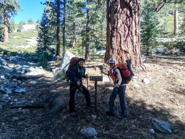
Next morning I met a lovely woman I had been chatting with on forums. We agreed to start the journey together in a non-committal way that we weren’t required to stick together, and see how it would go. I am always a bit socially awkward and nervous meeting new people, but she has a lovely sense of humour and we were both super nervously excited for our upcoming journey. She was awesome and even rented my bear can ahead of time, picked up my fuel (as you cannot fly with isobutane) and got some beta the day before from a ranger. We synced our inreaches so we could communicate and off we went.
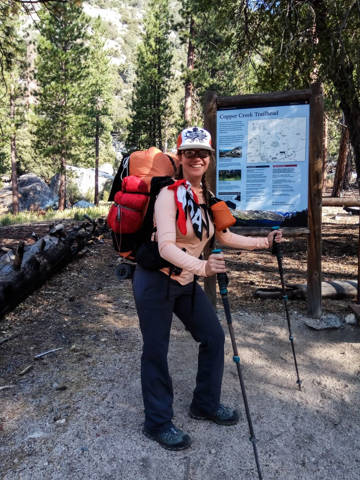
Day 1 – Setting forth:
Day one began after we finally introduced ourselves to eachother, we hurried over to the rangers station at 9am, got our permits, briefed ourselves with the ranger, then parked at Road’s End. I was a bit apprehensive as my pack was super full and heavy and I knew we had this looming 5000ft climb ahead of us with over 40 switch backs. We started out and it was very grueling, but fortunately we were just getting to know each other so lots of conversation helped ease the suffering. Danielle is the strongest most power house woman I have ever met, in both body and mind. We clicked pretty much instantly and it was a match made to hike.
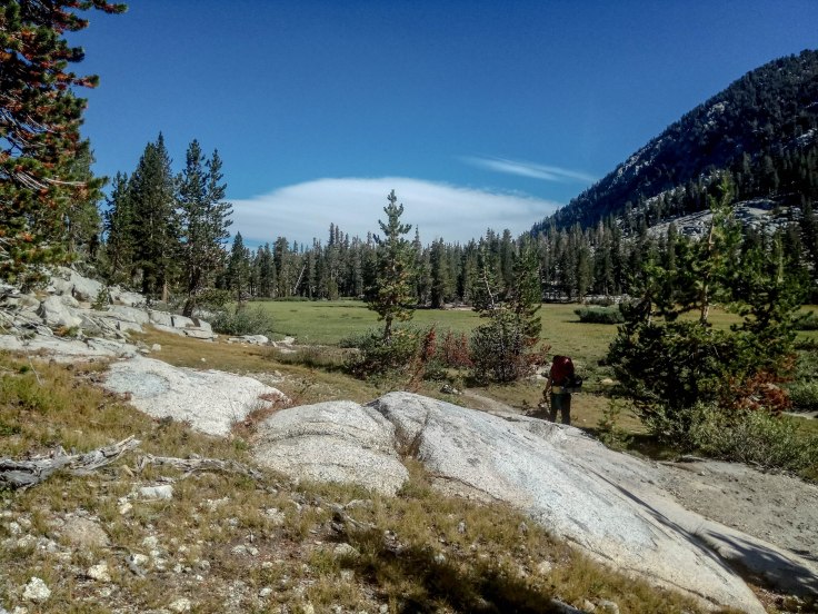
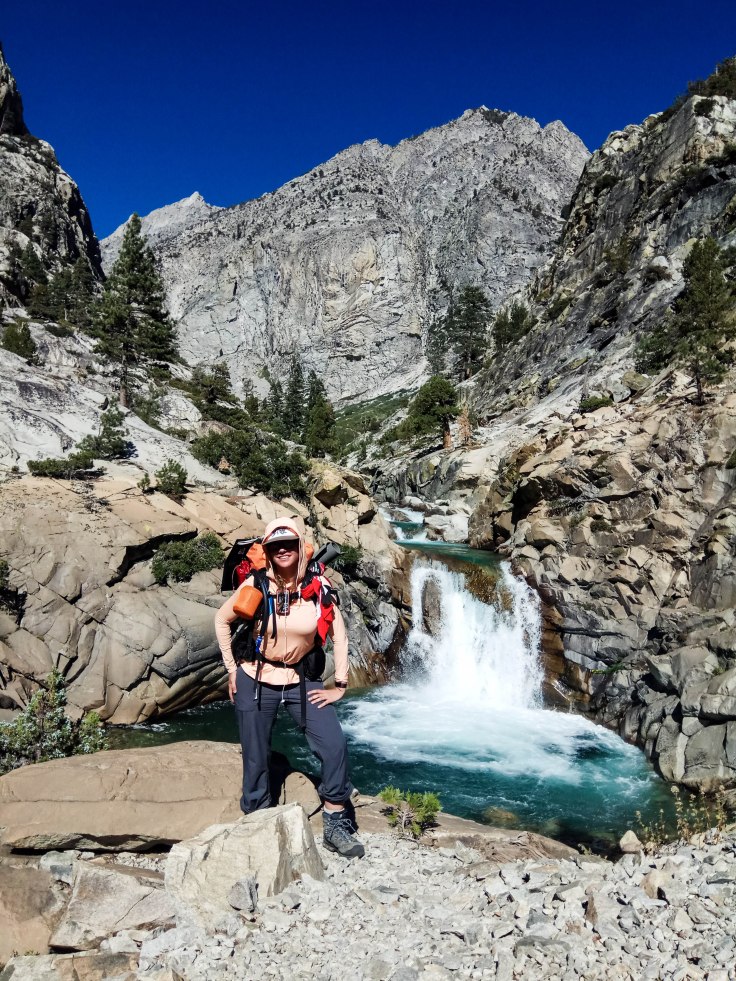
We reached just before Granite Lake junction about 10.5 miles, and set up our tent on some granite just past a water source. We got to see what we thought was a good “bear distance” away from our tents for our bear cans, cook dinner, laugh and watch a beautiful horse and mule train go by during dusk. Exhausted, accomplished, and happy!
Day 2 – A day of blunders:
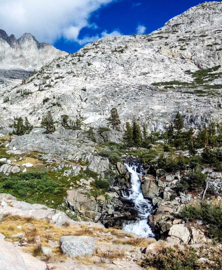
Next Day I really wanted to make Simpson Meadow as the time line for the loops was a bit aggressive. We headed out in high spirits and over Granite Pass. Was nice and early in the day so energy was high and the views were grand. Descending Granite past Lake of the Fallen Moon area was gorgeous and almost fairy tale. Getting into some of the granite there was a bit apprehensive as it was easy to lose the trail for a few moments. Being my first time in the area that would always get my heart rate up a bit.
We headed past this one area where you were supposed to cross the creek (in hind sight). We stayed the left, on the wrong side of the creek as the trail was not easy to follow and a spur trail continued on, resulting in an hour of us bumbling about trying to read our Inreach/Map/Compass, though it’s a gorgeous area for a camp site when I go again! I think this was around the East Fork Doughtery Creek. We finally back tracked and crossed this creek the correct way and started heading up, we were a bit miffed that we had made such a blunder but we were happy to be on track. About half a mile from the creek we checked our map and realized that was the last water source for a few miles so we had to back track to refill – even more miffed!
We headed up and up and then finally started our big drop into Simpson Meadow. It was already getting late and Danielle being the powerhouse ninja that she is, excelled on the down hill trek. So we agreed off she would go, and I would meet her at the junction. Little did we realize, dropping almost 4000ft would take longer then we would anticipate. Almost an hour and a half later as the light was growing thin we met up. We were both very tired as we had trekked 12 miles, our packs still very heavy with the full load (and remember our one hour bush-wacking wrong turn endeavour)!? We were a bit worn thin but found this super cute meadow next to a creek and hunkered down. Had a good laugh and patted ourselves on the back for being strong and capable, and went to sleep. Mile 22 – 5990ft

Day 3 – Why Hello Mr. Bear:
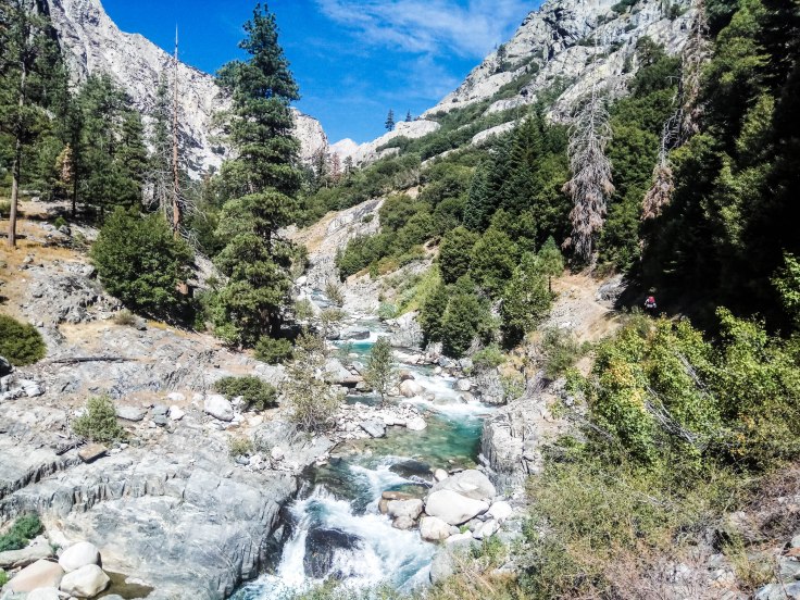
Day 3 was our “easy” day. Lots of miles but not crazy elevation. We set out from Simpson’s Meadow, walking about half a mile further from our camp ground we found some even choicer camp grounds (fire rings, flat, shaded) – little did we know we would utilize them on the return trip… Our goal today was to reach the JMT! We headed out in great weather. We were in some open areas that were nice and warm after Simpson’s Meadow, with great water sources, we spent an hour having a “bath”, drying out, and just in general soaking up the sun. Once we were well rested we continued on past Cartridge Creek over a wooden bridge up towards Devil’s Washbowl. We sat there for some time taking pictures of the beautiful river carving through the granite. Here we saw two other travelers, our first since Day 1 and had a lovely chat.
Walking farther up the canyon, we saw our first bear! It was getting close to dusk and our pace was hurried (there is no good camping spots from Cartridge Creek up just before the JMT junction). You could camp at Devil’s Washbowl but it really isn’t ideal. Mr. Bear was happily munching on some berries about 30 minutes from the river crossing just before the JMT. We yelled and made a lot of noise he sauntered off a few meters and we continued on. It was exhilarating and nerve wracking meeting a bear as we had felt pretty alone, but he was so at ease in his habitat.
We trekked on for about 30 minutes and decided to camp just off trail. We were about 15 minutes from the water crossing (in hind sight just push to the water crossing there is a good camp sight just before it). We had good access to water but camped on granite. Mr. Bear did not bother us that night. Just Before JMT – 30 miles – 7800ft
Day 4 – Welcome back to ‘civilization’:
First thing in the morning we packed up and knew we were about to hit the *looming* Palisade Creek crossing. This crossing had been deemed “unpassable” by the rangers just weeks before we headed out, due to the huge snow pack of 2017. It was late September now and just was deemed passable. It was scary. I removed my insoles and put my hiking boots back on. Untied my pack and slowly shimmied across the river/creek. It was mid thigh in the deepest section (I am 5’6) and boy was it strong. The scariest part is that the water was so turbulent that I couldn’t see the bottom to check the footing. Shuffling side to side and moving my hiking poles so I always had three sturdy points of contact was helpful – facing upstream as I went. Even moving the poles I could feel the strong rush of the current. Danielle and I shouted encouragement to each other as we crossed. We were successful and had some huge spikes of adrenaline.
Lots of laughing and I might have even had a tear of joy. I know we both faced a lot of fear doing that crossing and we were cautious and extremely proud in our success! I think it made us even closer as a duo as shared experiences can often do.
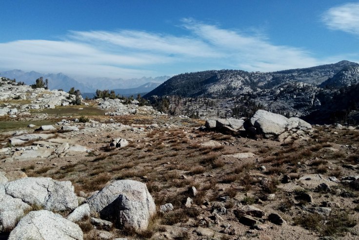
Hitting the JMT was almost a smack back into the world. Within about 10 minutes of hitting the JMT we met probably 8 people. In 3 days on the Copper Creek Trail we met 3. It was very jarring! Onward we trekked up to Palisade Lake. Up Up Up Up Up! The first 5 miles were really relaxing through open sections and forest following Palisade Creek. The last 2 miles were a bit “staircase-y”. We met some packers with horses and mules and some folks studying the mule’s and horse’s grazing habits – super chatty and nice to talk to some folks. We set up camp near Palisade Lake and chatted up those folks before the pass. Enjoying the last bit of sun I wore flip flops and warmed up on the granite. 40miles – 10000ft
Day 5 – Am I back in Canada?:

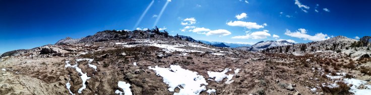
My tent has a ton of snow on it WTF?!? Where did this flip flop weather go? Fetch weather on the Inreach – ensue disappointment with the results. Some hikers were going on, some were turning back, packers were waiting, I wasn’t feeling too optimistic with the weather results. In hindsight we could have just kept going or hunkered down, but that is what hindsight is all about. Knowing our 12000’er Mathers Pass was right in front of us going into a blizzard felt like a ‘poor life choice’. I made the decision to turn back and Danielle agreed with me. We were already sleeping on the cooler side at nights, and knowing between Mathers and Pinchot there weren’t any bail out options we were worried if it got worse before it got better we would be in for a crappy time. A bit of sadness and some repetitive reassurance we were making good choices, we headed down.
We had a hard time following the trail down as it was covered in a lot of snow. The first 1.5 hours was a struggle, not quite white out conditions, hard to follow trail (even having walked it the day before so having somewhat of an advantage). We came across a PCT’er who had yoyo-ed to finish her final section. She had 20 odd miles to go but was hunkered in a tarp tent looking very dejected and ill-prepared for the weather change. We offered her snacks and said to play it safe – I hope she finished.
We boogied back down to Palisade Creek feeling a bit sad but talking ourselves up in having made the best choice with the knowledge at hand, knowing we could sleep easy having made the “safe” choice, we were still a bit cold and damp. We decided to cross Palisade Creek that day, it was slightly higher then it was the day before due to the snow fall but a) we were tired and just wanted to get it over with and b) I was worried the recent snow fall would make it even higher over night. Harrowing but successful. I know my husband was happy to get my Inreach message, and agreed it was a good call. We camped just on the other side of the creek in the woods and snow fell on us that night at Palisade Creek junction, such a juxtaposition to the night before! 51miles – 8000ft
Day 6 – Drying out:
Woke up to frost, my boots were still frozen from the creek crossing. We hiked down the towards the washbowl and saw Mr. Bear again! Hey Mr. Bear! Decent spirits and having been over the terrain already, life was great despite the few inches of snow on everything! After a few miles the over grown bushes had sagged over the trail and we could no longer see where were going (despite knowing down via the canyon along the river). We ended up getting up on a boulder field and slogging over it, literally climbing through and over the saggy bushes til we met up with the trail again, about a 30 minute detour. My anxiety/alertness was up during this time, any time the trail is lost I feel a bit on edge especially when it is dense, despite knowing the direction I needed to head and having many tools at my finger tips, there is something soothing about following a trodden foot path.
Back on the trail we boogied as it warmed up lower and lower. Time to dry out all our gear!
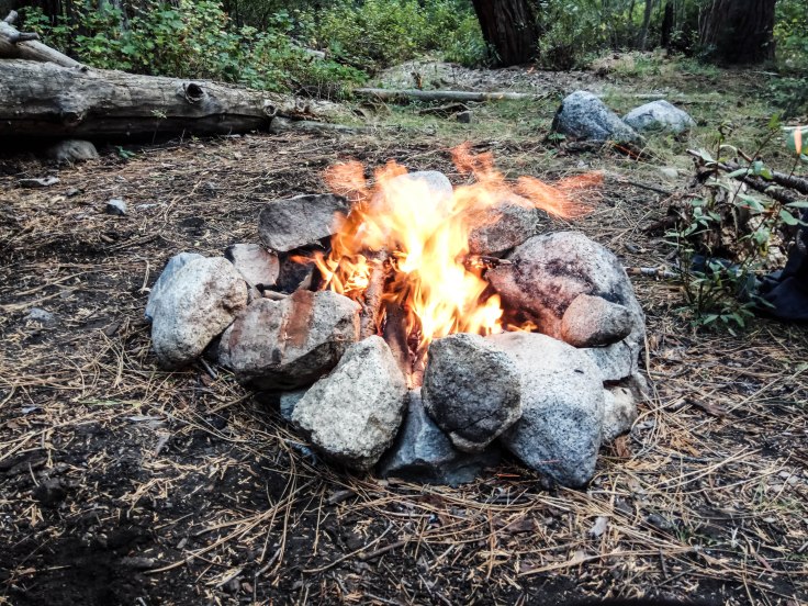
We got through Simpson Meadow and back to our area with the bitchin’ camp ground. A fire ring was there, we shall make fire!
Danielle made an amazing fire and it was so nice to truly dry out all our gear. Also nice to have the smell of camp fire my clothes instead of hiker stink. This was the best sleep I had at all the camp sights so far. We shared some whiskey she brought and looked back on our journey thus far. Simpsons Meadow – 59miles – 5990ft
Day 7 – Winding down and a bit of homesickness:
Well rested and ready to go we headed out. Up that stupid switch back section was grueling. I am the uphill queen so I headed off to find myself on the 30-40 switch backs up up up. I had a bit of a nap at the top as we met up for a mid morning pre-lunch. Getting over the hump towards that creek crossing where we got lost on the way in. This time we decided to make a little arrow out of sticks in case anyone else was going the other way, so they would not get lost :).
As we headed towards Granite Pass through lake of the fallen moon we were both getting pretty tired. We saw this meadow open up to us in the evening sun light. It called to us to make a camp sight, we happily obliged. I was feeling a bit homesick for some reason, maybe a bit sadness I wasn’t doing my original plan, and maybe just being lost in my head despite the excellent company. Was a bit of a down day (no pun intended), but some gorgeous highlights. 69 miles – 8500ft (guestimate)
Day 8 – Homeward Bound:
Spirits were very high as we knew we had a good chance of hitting civilization ie. a shower today. We first scrambled over Granite Pass (and a nice long pit stop here for some photos and contemplating what we had accomplished). Past Charlotte Lake then up one last time before our final switch back hell towards Roads End.
As I am much slower on the down hill terrain, this welcome message from Danielle at like switch back 25 was a welcome surprise.

We popped back out into civilization and I remembered I had some Buffalo Bleu chips in the bear can I left in the bear locker!
Woo hoo! 81 miles – 5035ft
We returned our bear cans and took off to find a shower. Feeling about as clean as pretty gross NPS showers can make you feel, I said good bye to my new forever friend. We had such an amazing adventure together, and to go from strangers to having such a profound experience, I will be forever grateful.
Was it what I had intended? No. Was it amazing? Yes. Did I learn a lot? Yes. Did I make friends? Definitely! Will I be back again? You betchya!
I know this overview was very light-hearted, if you actually want further details or specifics just hit me up in the comments or contact page!
I drove back to Fresno and met up with my good friends to have some amazing tacos at Ophelia’s (highly recommend for cheap fantastic post-hike mexican food!). I then drove to Mountain View to spend the last few days of my original itinerary to spend with some friends there <3. I had an amazing trip and cannot wait to try the Big Sexy Loop 2.0!!!

Sounds like an epic trip!
LikeLiked by 1 person
Yup, full of energy – just like you Holly!! Thanks for sharing your adventure.
LikeLiked by 1 person
I loved reading this. So glad that you turned back. Embrace whatever happens and keep yourself safe to hike another day. What were the dates?
LikeLiked by 1 person
Thanks! It was a trip of a lifetime, I definitely learned a lot. We went mid September around the 15th.
LikeLike
Great experience.
I would like to have the same on june 2019.
What was the month of your hike ?
What the temperature in the evening and on night ?
TY for your response
LikeLike
I went beginning of September. You will have high water crossings, the river crossing on Day 3 may be dangerous (depending on water levels). I heard you can bush wack up stream 300-400m to an easier crossing but I don’t have information. Would be worth asking the rangers closer to your start date. Temperature was hot out of King Canyon (the big climb on the first day was probably 30’s during peak sun). Average would be mid 20s (C) low of 3-8C (year before we had 6″ of snow over night so -5C roughly)? Temperature can be varied depending on the season and if you are close to a stream or up high). Good luck planning your trip!
LikeLike