
Having just spent six days in Glacier National Park in an often-overlooked section in the Two Medicine Region called Coal Creek/Nyack region, here is the trip report… also, here is my “Nyack Nyack” joke:
Nyack Nyack! Who’s there?
Hike. Hike who?
Huckleberries gleam,
In forest where bears roam free,
Wilderness delights!
Day 1 – Nyack Trail Head to Coal Creek Campground – 19.78km and 467m of elevation gain – moving time 4 hours and 50 minutes.
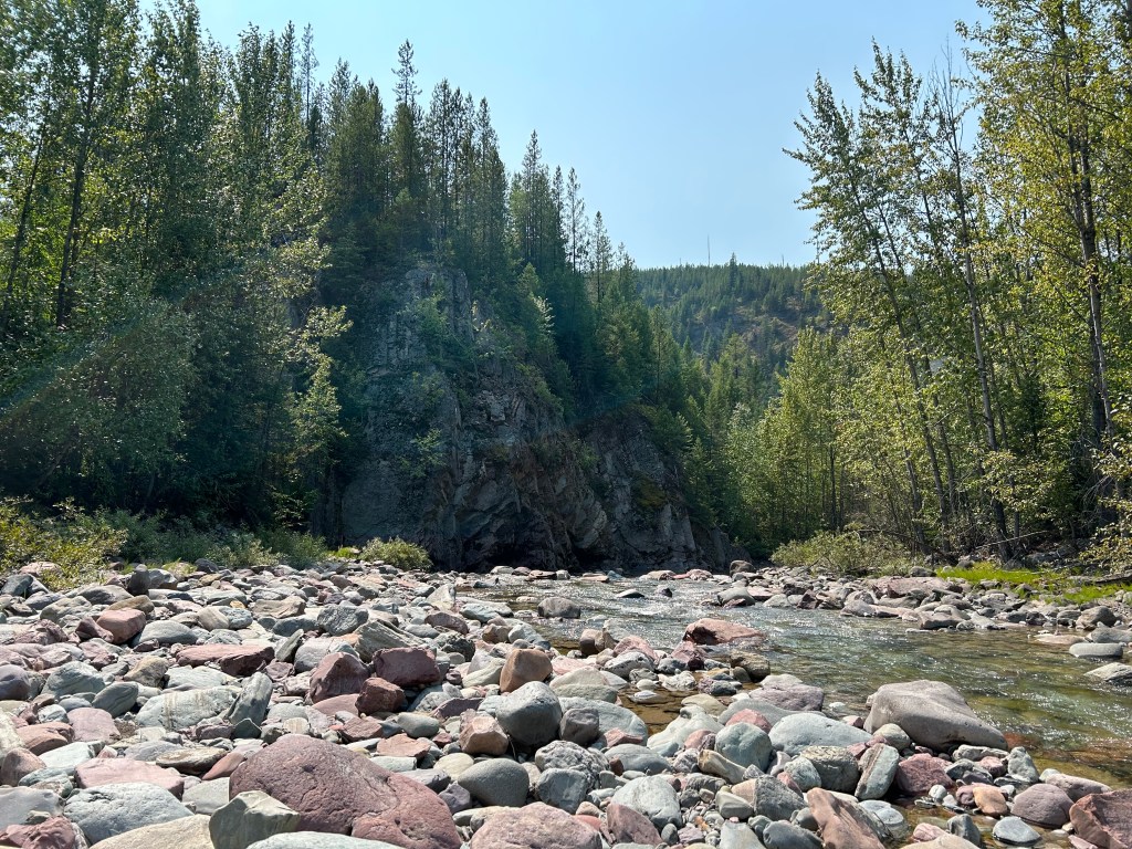
From the car parked at Nyack Trail head, we forged the Middle Fork Flathead River which was hip deep after several days of rain. The South Boundary Trail follows the river and appeared seldom used. It was quite overgrown and but was fairly easy to see through the brush. One we met up with the Coal Creek Trail and made our way to Coal Creek Campground. We saw no one!
Day 2 – Coal Creek Campground to Lower Park Creek Campground – 17.28km and 729m of elevation gain – moving time 5 hours and 26 minutes.
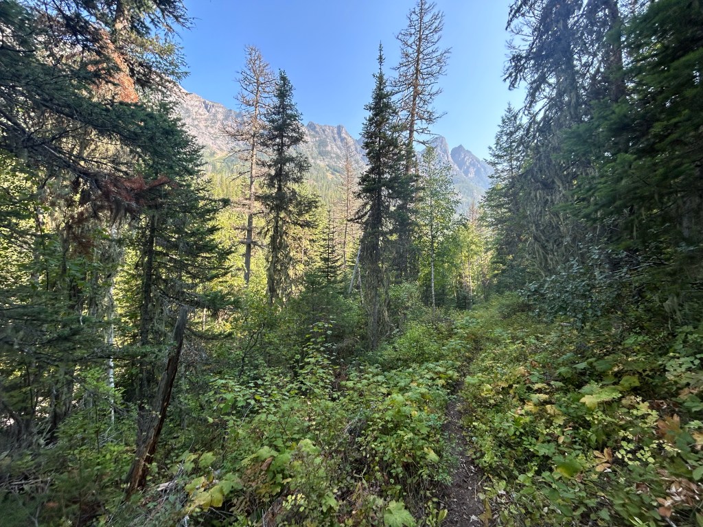
The first river crossing was slow going as the trail wasn’t very established after the water crossing. This area was an old burn and it appears the trail has been rerouted and doesn’t follow what the map says, so we spent an hour double checking maps, back tracking to the junction. This trail was the worst on the Park Creek side descending through a lot of deadfall and bushwhacking with no views. Many times, the brush was taller than us! We were welcomed to a glorious feast of huckleberries but at the detriment of them slashing up our legs. We saw one single person coming up the trail as we descended.
Day 3 – Lower Park Creek to Upper Park Creek Campground – 12.41km and 397m of elevation gain – moving time 3 hours and 6 minutes.
Easy rest day where we caught up on laundry. We slowly climbed the drainage and were greeted to more epic views and delicious huckleberries and thimbleberries. Lovely campsite by the creek and no one to be seen! We basked in the sun and relaxed.

Day 4 – Upper Park Creek Campground to No Name Lake Campground – 22.41km and 1263m of elevation gain – moving time 5 hours and 52 minutes.
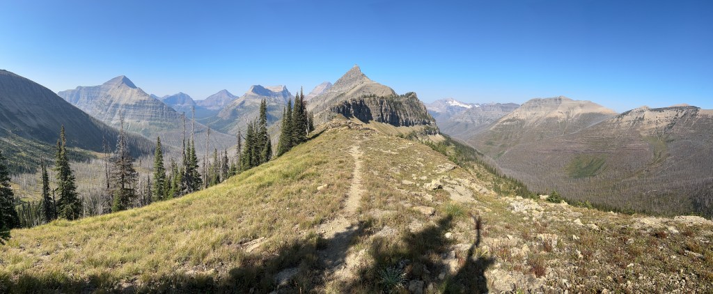
Huge climb up and out of the drainage and over Two Medicine Pass. This climb had a ton of great views and as we made our way over Two Medicine Pass and received an amazing glimpse at the east side of the park. As we descended, we finally began to see all sorts of day hikers from the Two Medicine region – it was a bit of a culture shock! We made our way around the Two Medicine Lake South shore and hiked up to No Name Lake. This was one of my favourite campsites and we shared it with one other group. Stunning view and we heard some rock fall during the night.

Day 5 – No Name Lake Campground to Lower Nyack Campground – 37.63km and 1052m elevation gain – moving time 9 hours and 34 minutes.

Holy heck this was the money shot day; Starting with an amazing sunrise on the east side of the park Dawson Pass is next level! Stunning ridge walks (and some butt clenching heights for me!) We get off the day hiking/popular area and head over Cut Bank Pass which drops into the Nyack drainage. Cut Bank Pass is gnarly and as you drop into the bowl the trail was steep and hard to follow. It goes through an old burn and was very very hot. There appears to be a very new ranger cabin and some nice trail maintenance over some sections here. Eventually the burn ends, and the trail becomes brushy. We pushed hard to get to Lower Nyack Campground which does not appear to be used often. Long day but we felt rewarded. Unfortunately, this drainage is very hot and dry, so all the berries were spent. Not a single person was seen.

Day 6 – Lower Nyack to Car! – 10.03km and 140m of elevation gain – moving time 2 hours and 17 minutes
Spirits were high! Quick jaunt out with some more lovely bushwhacking as we meet back up with that South Boundary Trail. Crossed the Middle Fork Flathead River which was way lower than the 6 days earlier! What a beautiful experience I absolutely loved this lesser hiked section of the park. Super easy to get permits and absolutely no one around!

I have to say my Fenix 7S was my favourite piece of gear! I loved that during the Hike activity it would show the map with the distance to the next trail junction. This was *so* much easier to use than the Inreach (which I also had of course), and I was able to cross reference it easily with the Two Medicine paper maps.

