
Note I do not receive any compensation and this is just a review of my experiences on the trail.
What is the Chilkoot Trail?
The Chilkoot Trail is a 53km (33 mile) trail that crosses from Alaska, USA to Northern British Colombia, Canada, just south of the Yukon Territory. You will follow the same path prospectors from the 1890’s followed to head to the gold fields! Tons of historic signage and artifacts along the way. If you are a history buff, or love multi-day treks, this one is for you! Parks Canada Overview
Preparation
The challenging part about planning to hike the Chilkoot Trail is organizing the travel to and from the different trail entry/exit points. Not overly difficult, however some careful planning is required as the trail end point in British Colombia is only accessible by float plane and train. The train does not operate every day, requires pre-booking, and the schedule is such that you will need to start with the exit train and work your way backwards to figure out your start date.
Travel
Being Canadian, I found it easiest to travel to Whitehorse. There is a 2.5 hour flight multiple times a day from Vancouver airport. There is a free airport shuttle at the Yukon airport for each domestic flight that takes travelers to the various hotels. We stayed at the Yukon Inn which has a restaurant on the premise.
WPYR is the company you will work with to sort out your train/bus to Skagway and the train/bus back from Bennett (the terminus of the trail).
Permits
You will need to get a Permit from Parks Canada (this will cover you for both the Canadian and the US side). You will select your camp sites and make the reservation. More info can be found here.
Camp Sites
There are nine campsites along the Chilkoot Trail. Each one has bear bins and toilets, most have tent pads and fully enclosed cook shelters. Most people strategically camp at Sheep Camp, the closest campground before the main pass of the Chilkoot Trail, additionally most people then camp at Happy Camp, the closest campground after the pass. A list of each campsite and the elevation profile and their locations can be found here. We camped at Sheep Camp, Deep Lake, and Bennett.
Gear List
I try to go fairly ultra-light, but since we were going to be on a tent pad I brought my free standing two person tent. In total I weighed in at about 23lbs for my pack, including food and 1L of water. Water is plentiful along the trail. Rain gear is recommended (it rained almost every day on our trip). I did the trip in trail running shoes which I normally hike in if I am not going off trail. Hiking boots are also recommended. Here is my complete gear list.
The Adventure
Traveling to the Trail
We arrived in Whitehorse around 11:30PM and took the free airport shuttle to the Yukon Inn hotel – checked in and slept. The next morning we grabbed breakfast at the Yukon Inn restaurant and walked over to the WPYR bus station office, which is about a 20 minute walk from the hotel. We booked this leg of the journey here (it was hard to find the exact bus/train we needed, but a quick email had us sorted out).
Here we met up with our bus driver and a few others and headed off to Carcross. We had a 30 minute layover in Carcross which is a beautiful little village, we grabbed a coffee from the cafe there and wandered around taking pictures. We will re-visit Carcross on the way back for 4 hours so I will dive deeper into that town later.
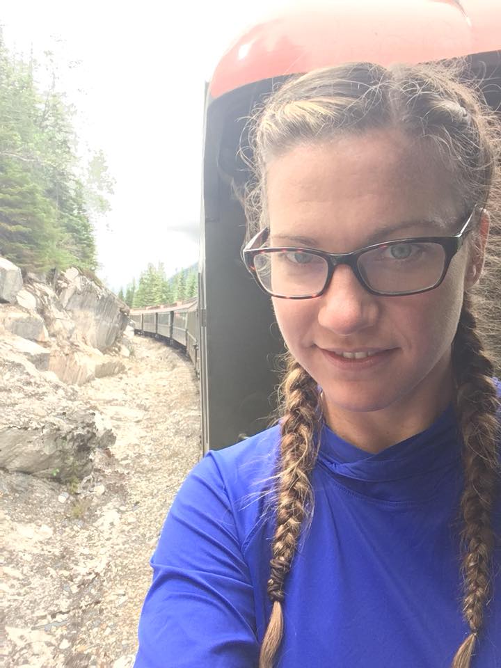
Next our bus continued on some way until we switched to train. This train took us all the way to Skagway. It was a scenic train with a narrated guide through the White Pass trail. You can stand outside the car to take pictures and it was truly an enjoyable time!
Once arriving in Skagway, we picked up our permits at the trail office, picked up fuel and bear spray at one of the local hiking shops, grabbed some lunch at Glacial Smoothies and Espresso (10/10 delicious!). Puttered around town, did some last minute grocery store shopping, and had dinner at The Red Onion (old brothel turned restaurant – would rate 4/10, service was good but food was meh).
We then met up with our shuttle driver Anne who was wonderful and drove us to the Dyea campground – her info can be found here. The campground, as of writing, is 10 dollars a night (either Canadian or US which is handy!). We set up our tent, played some cards and hit the hay.
Day 1 – Dyea to Sheep Camp – 15 miles total (with loop and extra from camp)
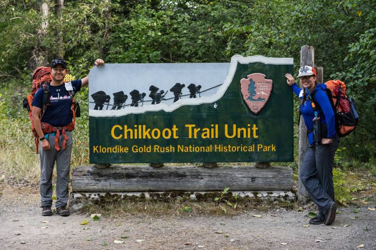
From the campground it is a half mile trail walk through the woods to the Chilkoot Trailhead. We snagged a picture in front of the sign and met up with a girl we met in town the day before. At around 9:30am, off we went towards Sheep Camp. We were warned by the ranger that the first mile of the trail is kind of the worst. If you look at the elevation profile you will see a large hill right off the bat. Sure enough up up up then down down down. It wasn’t too bad overall but I always fine in the first mile of any hike my body is like “what are you doing?! grr this is terrible!?” before it reluctantly goes “oh, I guess my complaining isn’t changing anything – fine I guess this is our life now”. Once that hill was done, we were in the flats. Through wet lands and coastal rain forest it was easy sailing for the first half of the day.
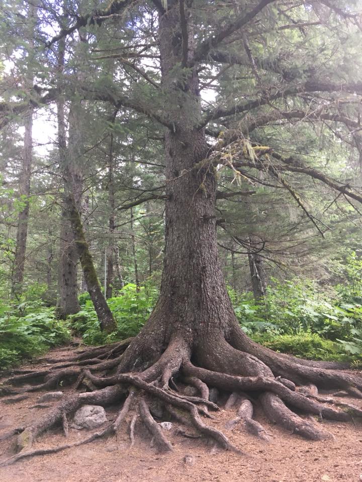
We stopped at Finnegan’s Point for our first snack break. There is a gorgeous old tree here which greets you like a Tree Ent from Lord of The Rings. Onwards we went to Canyon City.
Our next break here was quick, as we wanted to check out the Canyon City Ruins. We hiked across the sketchy suspension bridge and hiked the loop.
NOTE: This was not advertised as a loop and I was wondering if we were going to forever keep hiking away from the main trail (not literally but was questioning the route a bit in my head). Sure enough it loops back to the beginning where the suspension bridge meets the other side of the river.
The overgrowth hid most of what Canyon City Ruins had to offer, but I am happy we checked it out and there were some gorgeous glacier views from a river lookout spot.
We met back with the main trail and kept on hiking! The next section I would say is the worst section of the whole trail. Probably because it was a 13-14 mile day, but this section from Canyon City to Pleasant Camp was less then pleasant! It was rocky and elevated and undulating. I was pretty tired at this point and we sat in a pretty big huff at Pleasant Camp. Last stretch to go we made it to Sheep Camp around 5:30pm- a welcome site that was!
The ranger came around at 7PM to spook us into the trials and tribulations of the upcoming day as well as to share the history of the trail. He said however long it took you to get to Sheep Camp, on average that is how long it will take you to get over the pass to Happy Camp. He asked who was heading further on to Deep Lake and three parties, ours included, raised hands. I was a bit alarmed, realizing many people take multiple days to get to Happy Camp, but I think he was just setting a realistic expectation in that the following day was going to be a tough one!
Day 2 – Sheep Camp to Deep Lake – 10 miles
Funny story about this particular morning. After waking up and leaving my tent , I noticed there was no tents erected on any of the tent pads! Worried I had over slept, I checked my watch and it said 7:30AM. I guess everyone heeded the rangers guidance and set out super early!
Heading to the cook shelter as a few stragglers were just leaving, the only people remaining just so happened to be from the three parties who were heading to Deep Lake camp today (the one beyond Happy Camp). We all laughed among ourselves, joking that us longer mile people just needed our beauty sleep. 🙂
Off we went heading towards the looming pass, up, up, up, meeting some of the other folks from the night before along the way. We started to get above the tree line and that is when the views began to open up. Waterfalls galore! We hike through some stream crossings before heading to the scales. This is where the miners gear was weighed showing they had 1 tonne of goods to enter Canada. Here we could see the pass and a few dots of people hiking it.
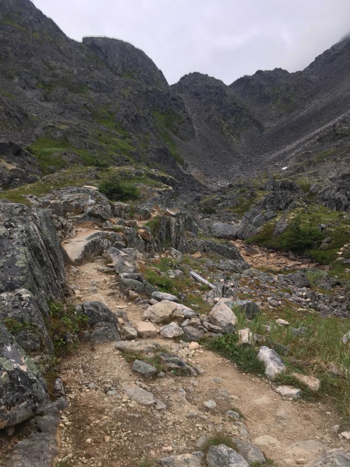
The pass was tough but manageable. It was rocky talus and boulder fields, you could hop one to the next. I found the terrain completely fine however the winds were gusting I would guess around 30-40kph, and I found sometimes that unnerved me a bit. However brave children and older folks were doing no problem so I pressed on, not to be outdone.
The top of the pass had some snow patches before the warming hut. We hung out up there for around 45 minutes taking photos and warming up. Finally we began to descend into the Canadian side of the trail.
This side of the trail felt more rugged. Lots of rock fields, water crossings with no rock hopping, cairns to follow. Feet did not stay dry, and I was very grateful I wore trail running shoes and not dry gore-tex boots!
Once we got to Happy Camp it was around 4:30PM. Since there were no cook shelters at Deep Lake, we decided to make Cup of Soup in the cook shelter at Happy Camp. We met up with a few groups who were also going to continue on to Deep Lake. Finally we went off on the last 2.5 miles we needed to finish that day.
Deep Lake was dreary as we had started to get a fair amount of rain, however it was not without beauty. Wild blueberries and huckleberries abounded. The wind howled most of the night however it was a quiet camp and I am glad we chose to stay there.
Day 3 – Deep Lake to Lake Bennett – 10 miles
Deep Lake to Bennett was a welcome change of pace. There had been a bear restriction so we had to travel in groups of four between Deep Lake and Linderman City. We sat by the junction nomming on wild blueberries until some travelers from Happy Camp strolled by. Sticking out our thumbs, we got in line and started marching along behind.
Taking a break at Linderman, we checked out the interpretive tent, had a morning snack, and picked up our trail completion certificate. There we met a Canadian ranger who said the bear restriction is now lifted so we slowly peeled out of camp one by one and headed off.
This section of the trail takes you back into the woods and the views are a bit bland (in the grand scheme of things). Marching along up and down rock/trail until you finally get to Bare Loon Lake. This camp site is gorgeous and overlooks a lovely lake. Many people stay here for their final night and it is not without merit.
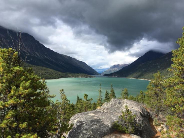
We chose Bennett Lake to stay our final night so off we went. The final stretch of the trail hits sand – lots of sand! Makes for an odd final slog but the views are stunning.
Finally you get to a panoramic sign and hop up on some rocks – be sure you do because wow!
Traveling Home
Taking the train out of Bennett was straight forward, as it is a few minutes walk from the camp sites. They put all the stinky hikers together in one car, the sight seers are in the other cars.
Travelling back to Carcross we had a four hour layover before bussing to Whitehorse. Here we went to The Bistro (10/10 busy but food was great), which had a fantastic poutine and some great local beers on tap including a nice Kolsch! Here we did some shopping – there are many local First Nation artists with gorgeous and reasonably priced hand made items. I found the shopping here to be much more unique and less expensive then in Skagway. After our layover, we hopped onto the bus and back to Whitehorse.
Once back at WPYR bus station, we walked over to the Yukon Inn and cleaned up and grabbed dinner. Great success! We donated our bear spray to the front desk to give to any other hikers who may want some.
The Recap
Overall, easily doable trail if you are in shape and train on some mountains/hills/stairs. I met an amazing gentleman from Tasmania of the spry age of 72 who completed it. He found the going tough and had a much more paced itinerary then ours, but mission complete! Trail runners can complete this trail in one day, though that sounds like it would be hella tough and not sure how logistics would work. Going solo is fine, you will meet lots of people each night if you want to. We didn’t see any bears, though lots of bear poop!
Happy Hiking!

Leave a comment